Our friends at OpenDataNI have been busy securing some fantastic spatial data sets for public use. in particular LiDAR surface elevation data collected by various NI Government Departments over the last 12 years. I’ve covered LiDAR technology in a previous post showing how it…
Where Am I Now? Developing an Open RTK GNSS Positioning Service for Belfast. Part 1
RTK GNSS? How Does That Work? For years land surveyors and geospatial professionals have been using a very accurate global coordinate positioning technique called Real Time Kinematic or RTK. RTK uses two or more GNSS receivers. GNSS is a modern…
Web Mapping and Spatial Visualization for Teaching, Learning, Presentation and Outreach
The Centre for GIS and Geomatics within the School of Natural and Built Environment specializes in teaching and research related to the science of geographical information (GIS). Geography is everywhere! Increasingly data gathered around the world on movements, trade, retail,…
Why High-Precision GPS is Important – A Post from Neolithic Shetland!
Dr Will Megarry, Centre for GIS and Geomatics, School of Natural and Built Environment, Queen’s University Belfast Shetland, 2nd June 2017 [The North Roe Felsite Project has been funded by the National Geographic Northern European Exploration fund] INTRODUCTION Global…
Open Data and 3D Visualisation

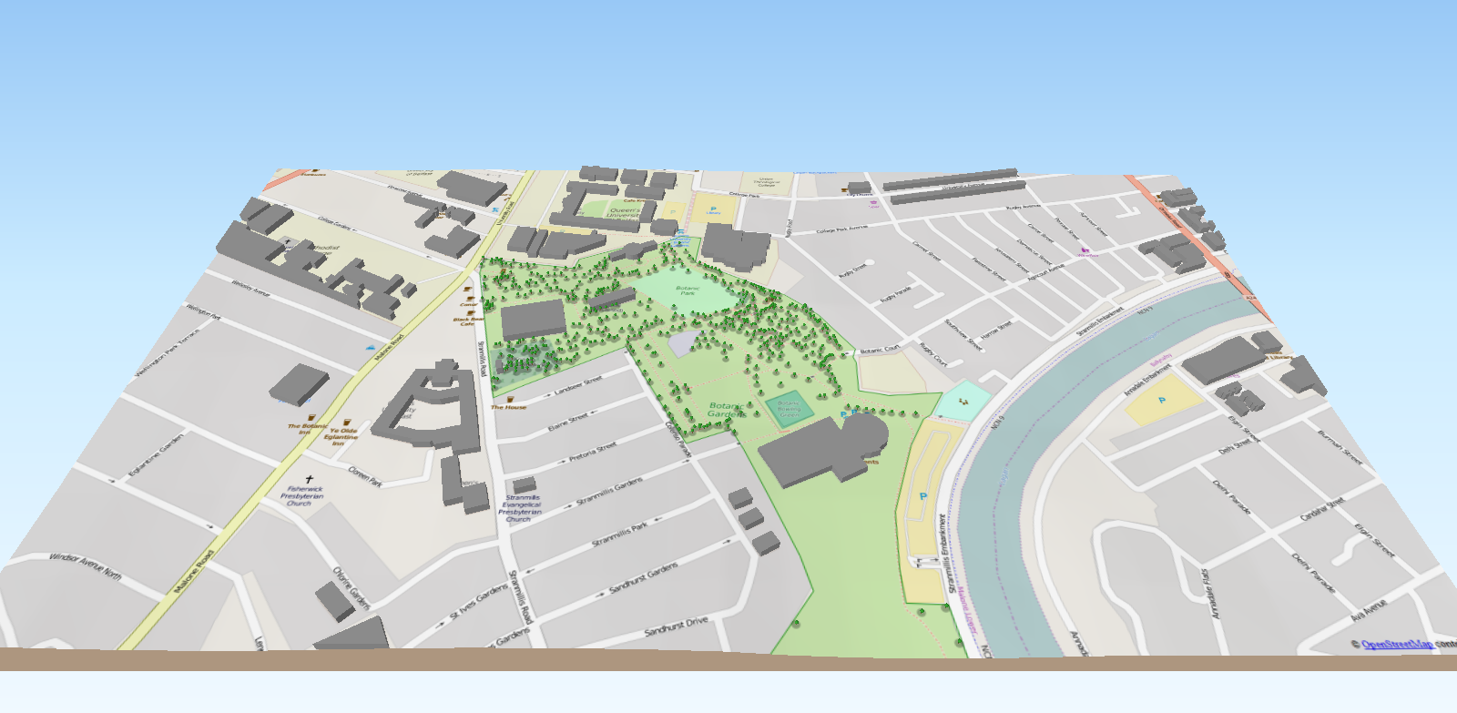
Lorraine Barry, Geographical Information Scientist from the GIS Research and Teaching Unit at GAP comments on 3D local visualisation based on open source methods and open spatial data. Traditionally within a geographical information software system (GIS) modelling spatial features in 3D…
Ireland’s Surveying Heritage – past, present and future.
Beginning a series of guest posts by colleagues utilising Geographical Information Science at GAP, Professor Keith Lilley writes on the often overlooked but internationally important survey heritage of the Island of Ireland. Ireland was the first country in the world to be fully surveyed…
Aerial Light Detection and Ranging (LiDAR)
To begin a series of posts about some of the mapping techniques we utilise at the Geographical Information Science (GIS) Research Unit here at SNBE, lets take a look at Aerial LiDAR. Aerial based Light Detection and Ranging (LiDAR) has become…
Newly Updated GIS Research Unit Website
Please visit our new website! http://go.qub.ac.uk/qubgis
Welcome to the GIS Research Unit Blog!
Welcome to the GIS@GAP Blog! The GIS Research Unit at GAP specialises in research, teaching and support in the diverse area of Geographic Information Science (GI) and Geomatics. At the core of GIS at GAP is a dedicated state of…
