To begin a series of posts about some of the mapping techniques we utilise at the Geographical Information Science (GIS) Research Unit here at SNBE, lets take a look at Aerial LiDAR.
Aerial based Light Detection and Ranging (LiDAR) has become an important digital mapping technique and an increasingly valuable tool in environmental and heritage management research here at GAP. Terrestrial (ground based) LiDAR can also be used to map structures, buildings and landscapes generally at smaller scales than aerial surveys and without the need of access to an aeroplane! (more on this in a future post).
LiDAR is essentially a laser based measurement system. In Aerial LiDAR an aircraft (plane, helicopter or a larger drone) flies overlapping tracks up and down over the survey area (called lawn mower patterns). A high speed laser pulse is sent out from the plane, the pulse hits the ground or a surface object and is reflected back to the ‘sensor’ in the aircraft. The time taken for all this to happen and the recorded intensity or strength of the laser return is used to calculate the angle and distance to the target from the sensor and its 3D (XYZ) coordinate location on the ground.
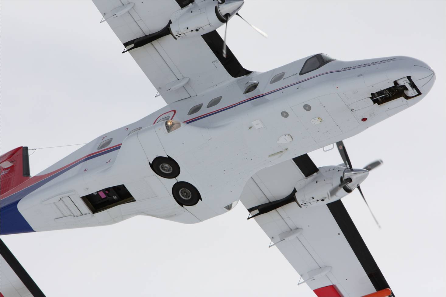
LiDAR Sensor, opening behind aircraft wheels. (NERC)
Because the laser measurements are combined with an on board GPS and information from the very accurate navigation systems on the aircraft, the ground coordinates can be mapped to a very high degree of accuracy (centimetres) and very high fast! Modern LiDAR systems can send out tens of thousands of laser pulses a second resulting in millions of 3D measurements, mapping large areas in one flight and can ultimately create very high resolution 3D Digital Surface Models (DSMs) recording the landscape below including buildings, roads, individual trees and even livestock without having to touch the ground!
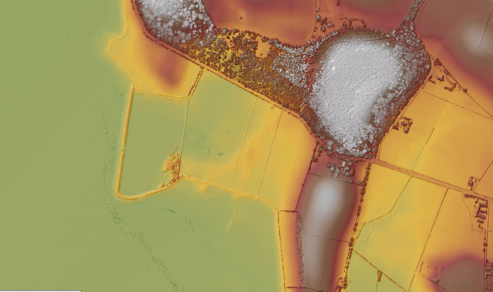
As an extra step because the number of points being recorded and the unique way the laser pulse is reflected back to the aircraft as it hits objects on the way to the ground, the laser ‘returns’ can be classified and filtered to remove features like trees, buildings and roads allowing researchers to extract and ‘clean’ the data of surface features, objects and vegetation. This new Digital Terrain Model (DTM) essentially records and models the landscape below as ‘bare earth’ without any vegetation or structures sitting on top! This is a powerful tool for identifying archaeological and historical features lost under forest and vegetation, but still may be visible on the surface, and is used to model, map and help predict the extent of river and coastal flooding in urban and rural environments. When combined with multiple flights over a period of time slope and ground movements can be monitored and measured to help understand, study and help predict ‘GeoHazards’. Finally the LiDAR derived DSMs and DTMs can be used to create 2D & 3D visualisations of the surveyed landscape.
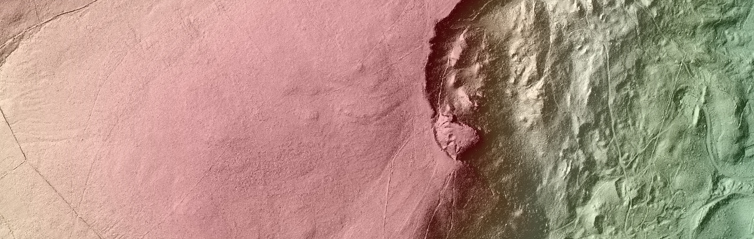
LiDAR derived hillshade model. Garron Point, Co.Antrim. (GISGAP/NERC)
Unfortunately due the capital costs of running an aerial LiDAR system (an aeroplane!), the GIS Research Unit at GAP does not own an aerial LiDAR system but we can still get access to LiDAR data through dedicated research applications, commercial suppliers and government agencies. In Northern Ireland LiDAR mapping surveys have been flown by commercial companies on behalf of the Rivers Agency (Flood Modelling) and Northern Ireland Environment Agency (Mapping Archaeological Landscapes). We have also acquired dedicated aerial LiDAR data for GAP research projects from the Natural Environment Research Council Airborne Research & Survey Facility and from the Ordnance Survey of Northern Ireland who are the current custodians of the River Agency LiDAR data. All this data although collected for specific projects can be shared by researchers studying different fields and can be used for teaching here at GAP.
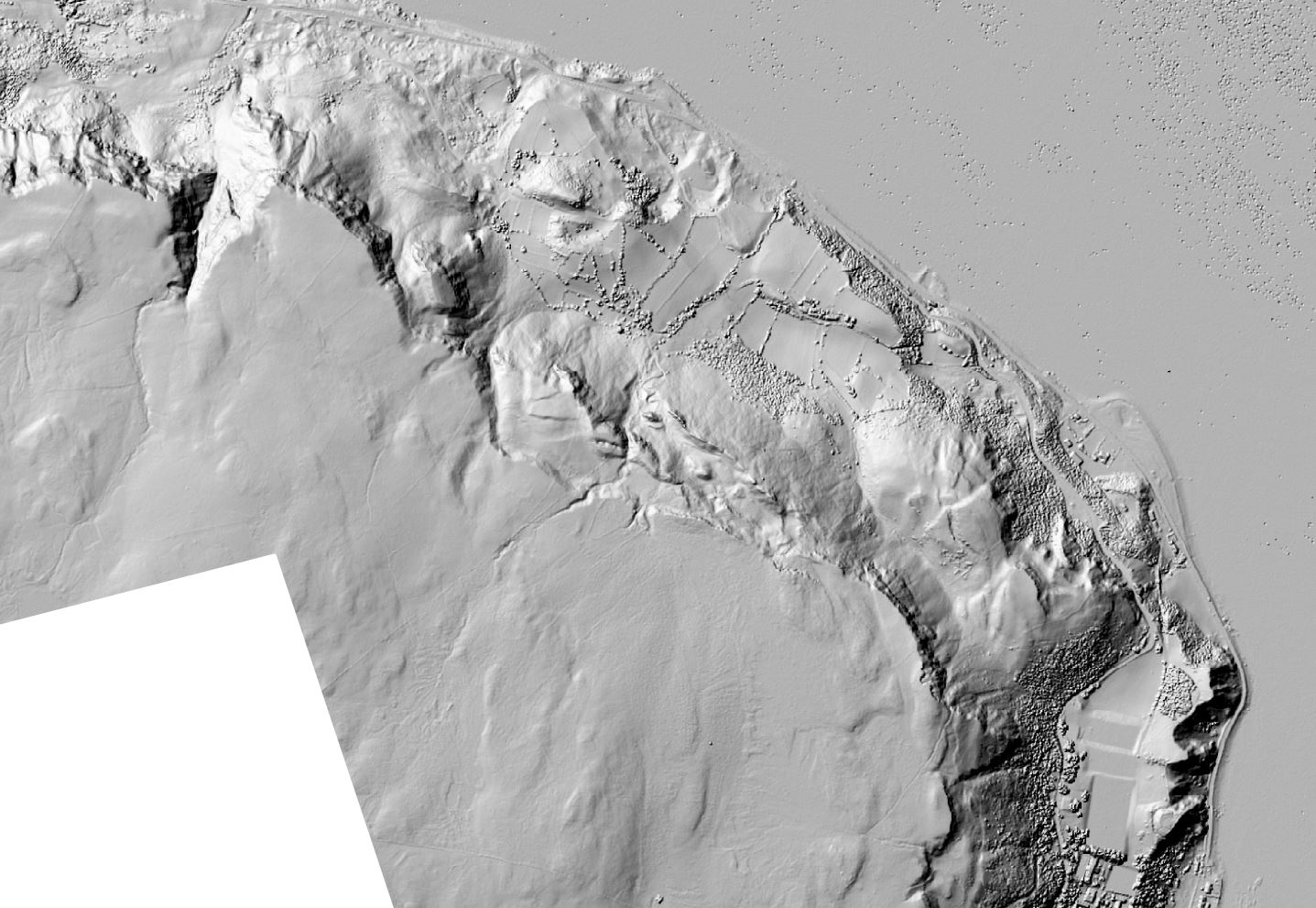
LiDAR DSM Strangford Lough, Co.Down. (GISGAP/NERC)
More recently other national government agencies are starting to make all their LiDAR data free to download (OpenData). England’s Environment Agency has over 10yrs of LiDAR data covering over 70% of England free to download! Wales and Scotland are to follow. With England taking the lead in publishing publically funded LiDAR datasets on the web it is only a matter time before Northern Irish and Irish agencies follow suit. (Don’t worry we keep asking!).
For the future we may be able to collect our own LiDAR data through the use of drone and UAV technologies as the sensors become lighter, smaller and hopefully cheaper! So watch this 3D space!
About the Author:
Conor is the Geographical Information Systems (GIS) Research Officer at the School of The Natural and Built Environment, Queen’s University Belfast and manages a dedicated GIS Research and Teaching lab with colleagues Lorraine Barry, Jennifer McKinley and William Megarry. An active GI Educator and Researcher for over 15yrs , STEM Ambassador and a member of the The Society of Chartered Surveyors Ireland and Royal Institution of Chartered Surveyors with interests in Geomatics, Geodesy, Digital Survey, Remote Sensing, Web Mapping and spatial data collection and analysis utilising UAV/Drone technologies. When not working with, or collecting Spatial Data Conor is a very keen Mountain biker (with a GPS attached)!
Conor,
May I ask what make and model of aircraft this is? Looks similar to and Aero Commander with a custom back door for sensor installation.
Chris
Hi Chris. I’m not completely sure of the aircraft NERC use, it’s not ours 🙂 You are correct, the openings at the rear of the aircraft are openings for the Lidar sensors.
Thanks for the interest!
Conor.
Hi Chris,
I’m wondering if you know of any available Lidar survey data for Castlewellan Forest Park?
Hi Beverly,
Thats for getting in touch. At the moment at least on public release I don’t think so: https://www.opendatani.gov.uk/dataset?q=LiDAR
Sorry!
Conor.
Hi there… fascinating ! Was reading a piece about the amazing results in the Netherlands using LiDAR and community archaeologists to identify new unregistered sites of interest.
Is there access available to date/ maps for NI by the public?
Your post provides a comprehensive and engaging insight into the applications of Aerial LiDAR technology. It’s fascinating how LiDAR’s accuracy and data processing capabilities contribute to environmental and heritage research. The potential for open data initiatives and the evolving role of drones in data collection add an exciting dimension to the field. Thank you for sharing your expertise!
Your words of encouragement couldn’t have come at a better time. It’s like you knew what I needed to hear. Thank you for being a source of positivity.