Newly Digitised: Maps of the Escheated Counties of Ireland, 1609
Introduction
We are delighted to share the newest addition to Digital Special Collections & Archives: Maps of the Escheated Counties of Ireland, 1609.
This is an atlas containing 31 facsimiles of maps of Ireland ca. 1594-1609. It was published by the Southampton Ordnance Survey office under the direction of Sir Henry James R. E. in 1861. The atlas, which remains available for consultation in Special Collections, is now also available online. For further bibliographic details, please see the catalogue record.
The atlas can be broken down into three sections: Richard Bartlett’s maps of Ulster; the Bodley maps; and finally, John Thomas’ map of the siege of Enniskillen castle.
Bartlett’s Maps of Ulster
The first three maps in this atlas, A Generalle Description of Vlster, Tyrone &c., and Tyrconnell &c., are by Richard Bartlett ca. 1602-1603.
A skilled map-maker, Bartlett has been described as embodying three key elements of the profession: “geographic judgement, cartographic professionalism and artistic flair”.[1] The three maps in this atlas belonging to Bartlett exemplify this description. They are rich in detail and wonderfully illustrated.
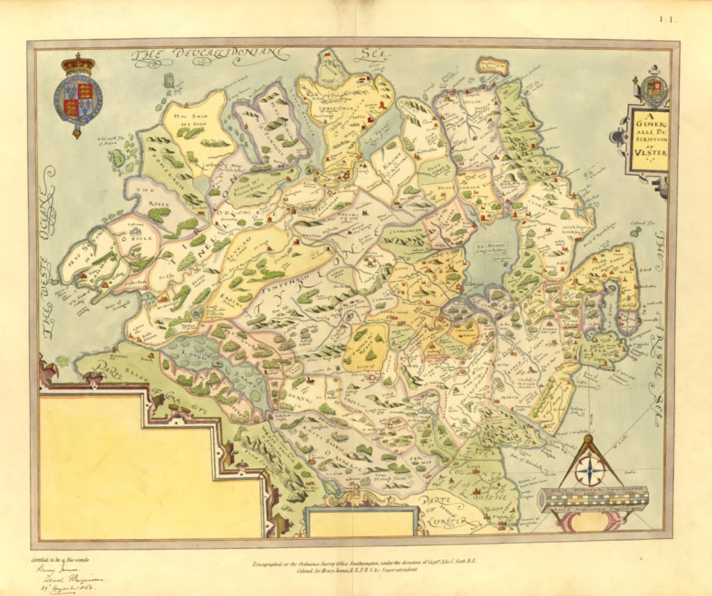
On first observing A Generalle Description of Vlster, I noticed that the majority of the detail is concentrated on the eastern portion of the map, with comparatively little in the Tyrone and Donegal (“Tirconnelle”) regions. It has been suggested that these flaws may have inspired Bartlett to move into these areas to collect this missing information.[2] However, in the historical context of the tail end of the Nine Years War, this was a dangerous proposition.
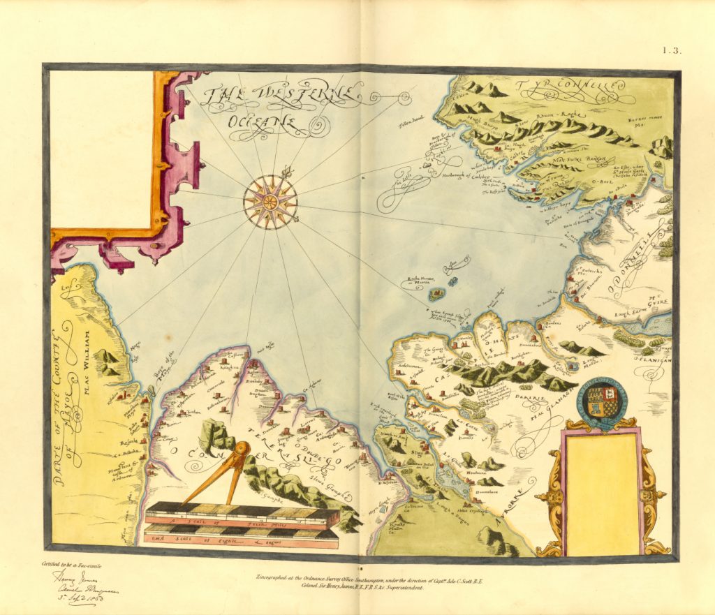
These are three of Bartlett’s final maps. During his time in Donegal, Bartlett was captured and killed by the local people. According to Sir John Davies, writing to Robert Cecil: “…when he came to Tyrconnell the inhabitants took off his head, because they would not have their country discovered.”[3]
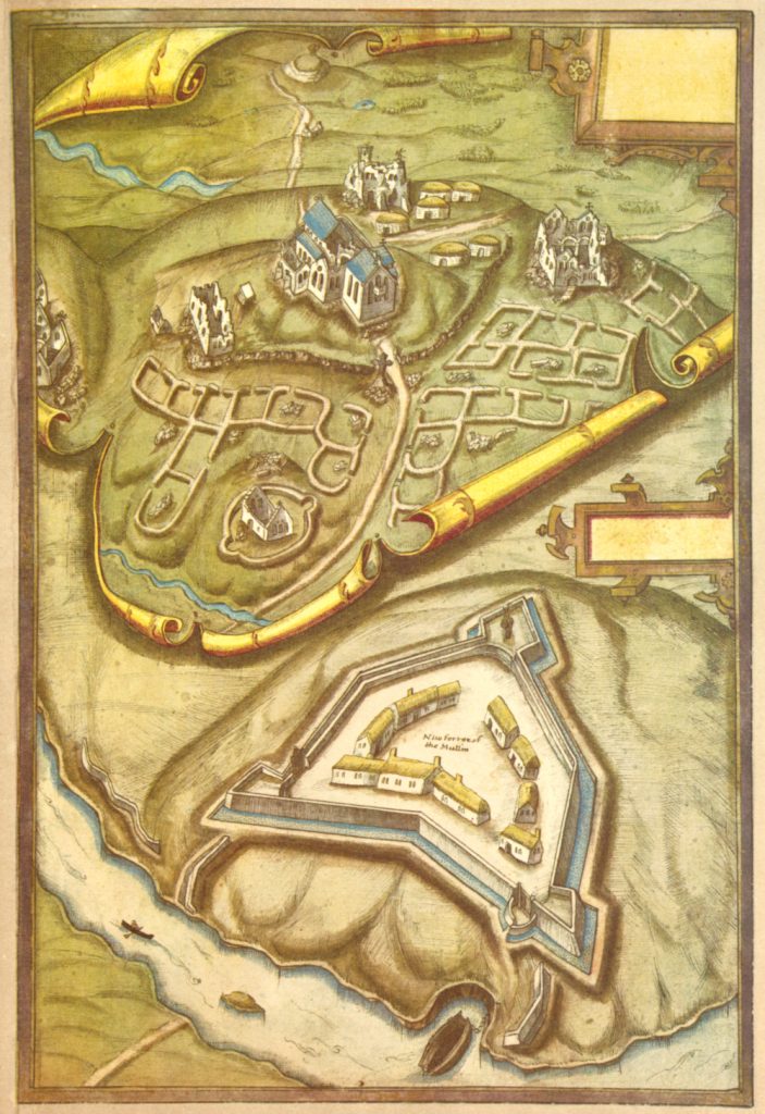
This map of Donegal Bay and Sligo Bay is the final one created by Bartlett before his death:
Discover More About Richard Bartlett
Special Collections holds items which elaborate on Richard Bartlett. The Queen’s Last Map-Maker: Richard Bartlett in Ireland, 1600-3 by J. H. Andrews provides a detailed examination of Bartlett’s cartography and time in Ireland:
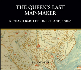
This book is available for consultation in Special collections. See our catalogue for further details.
Ulster and Other Irish Maps: c. 1600, edited by G. A. Hayes-McCoy is another excellent resource covering the journey of Bartlett and including many of his maps in Ireland:
Armagh and the Third Blackwater Fort 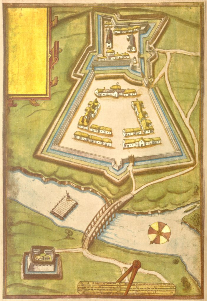
Charlemont Fort 
Dungannon, Tullahoge and a Crannog 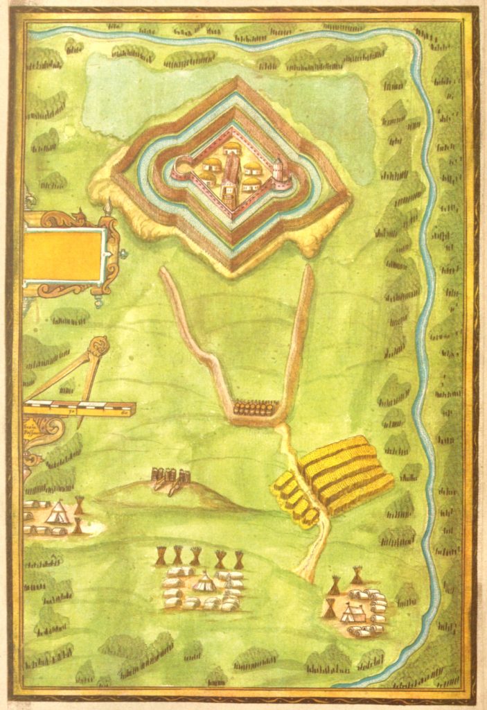
Inisloughan Fort
This item may also be consulted in Special Collections. Bibliographic details are available here.
The Bodley Maps
The maps following Bartlett’s begin to take on a different look:
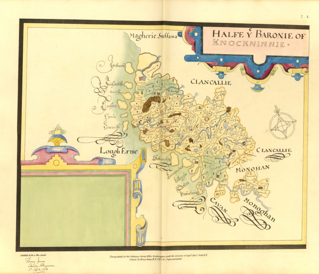
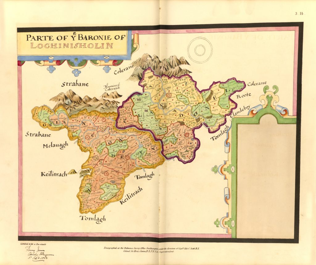
The ‘Bodley’ maps form the bulk of Maps of the Escheated Counties of Ireland. These are so named as Josias Bodley was responsible for the survey wherein Ulster was mapped for plantation.[4] This atlas contains 27 of the Bodley maps, originally dated 1609-1610. These cover Fermanagh; Tyrone and part of Derry; Cavan; and Armagh and part of Louth.
These maps are still the subject of academic research. One example, ‘Mapping Worlds? Excavating Cartographic Encounters in Plantation Ireland through GIS’ demonstrates the potential offered by Geographical Information Systems (GIS) in analysing this map of Loughinsholin:[5]
The Siege of Enniskillen Castle
The final map in this atlas is John Thomas’ representation of the siege of Enniskillen Castle:
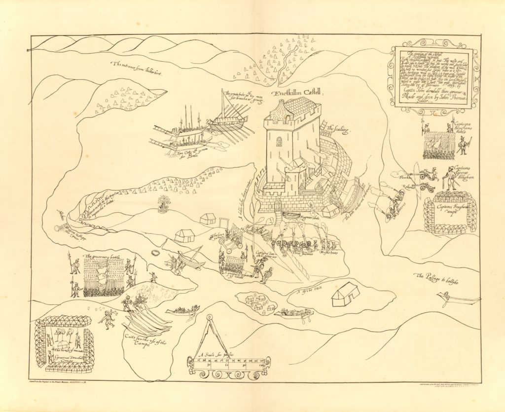
Within the context of the outbreak of the Nine Years War, this map provides an illustration of Captain John Dowdall’s siege of Hugh Maguire’s stronghold in Enniskillen.
The siege took place between 25 January and 02 February, 1594.[6] The map, drawn by Thomas (a soldier according to the note in the top right hand corner of the map), shows the castle strategically surrounded by Dowdall’s forces. The only Irish presence in this map is seen either firing muskets from behind the walls, or as heads on spikes in Dowdall’s camp:
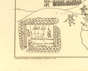
Dowdall was “an old hand” in the beheading business.[7]
Thomas’ illustration has been described as “freeze-framing a moment before slaughter”.[8] This is because after capturing the castle, Dowdall commanded the summary execution of “most, if not all” of the men, women, and children inside.[9] The map may well have been intended as a warning not to oppose English rule.
Summary
In addition to the 31 maps, the atlas includes an index and a letter from Thomas Ridgeway, treasurer of Ireland, to Lord Salisbury dated 17 March 1609 relating to the plantation mapping. The resource, which is available here, will be accessible 24/7.
Interested in Finding Out More?
- Special Collections holds 2 more map collections, the Ewart Map Collection and the Hibernia Regnum Map Collection. Full listings of all of our map collections are available from this webpage.
- An overview of the maps and atlases held in Special Collections can be found in the following blog and infographic guide.
- A selection of Ireland maps from the Ewart Map Collection have been made available via Digital Special Collections & Archives, and may be accessed here.
- Another historically significant atlas, the Atlas geofráfico de España, is also available online.
- All of our other maps and atlases are searchable via our catalogue.
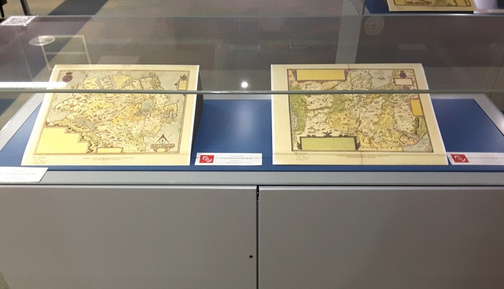
McClay Library Display
An exhibit featuring a selection of prints from Maps of the Escheated Counties of Ulster, 1609, was installed in floor 1 of the McClay Library on 03/02/2020:
Accessing our Collections
Access to our digitised maps and atlases is provided via Digital Special Collections & Archives. All of our maps and atlases are available for consultation in the Special Collections Reading Room. Learn more about visiting here, or contact us via email at: specialcollections@qub.ac.uk
References
[1] Andrews, J. H. (2008) The Queen’s Last Map-Maker: Richard Bartlett in Ireland, 1600-1603. Dublin: Geography Publications, 9.
[2] Ibid 36.
[3] Calendar of the State Papers relating to Ireland (CSPI) 1601–1603, 280. See ibid 35.
[4] See: Andrews, J. H. (1974) ‘The Maps of the Escheated Counties of Ulster, 1609-10’, Proceedings of the Royal Irish Academy: Archaeology, Culture, History, Literature, 74, 133-170.
[5] Lilley, K. and Porter, C. (2013) ‘Mapping Worlds? Excavating Cartographic Encounters in Plantation Ireland through GIS’. Historical Geography, 41, 35-58.
[6] For a detailed description of the siege, see: O’Neill, J. (2016) ‘Three Sieges and Two Massacres: Enniskillen at the Outbreak of the Nine Years’ War, 1593-5’. The Irish Sword: the Journal of the Military History Society of Ireland, 30, (121). 241-9.
[7] Palmer, P. (2014) The Severed Head and the Grafted Tongue: Literature, Translation and Violence in Early Modern Ireland. Cambridge: Cambridge University Press, 29.
[8] Ibid 28.
[9] Ibid 6, 244.
These are beyond wonderful. Excellent resource for scholars.
Thank you.
Many thanks for your kind words! We’re very pleased to have been able to make the resource available.
Bartlett’s maps are beautiful. I bought a digital copy of his Donegal/Sligo bays from TNA for an essay I was writing for my BA at the tíme, ca. 2013. When you zoom in on it you can see he’d marked many shipping hazards, sand bars, etc that might have been obstacles to ships. I think his job was to provide info that would inform plans for an attack from the sea rather than just providing more detail to match that given in the eastern part of Ulster. He was trying to ‘discover their country’ and their seas.
Thank you very much for your comment. There is no denying how beautiful the maps are! That is really interesting about the shipping hazards. It is an aspect of the maps I haven’t looked at before and will definitely check out. I’d love to read the essay if it is something you still have access to?
The index for the book has 3.17 The Baronie of the Omey but this map appears to be missing. Is there a reason for this?
Good afternoon. The Baronie of Omey is a part of this collection but it wasn’t bound in the atlas, We can’t say for sure why this is, but we suspect it is to do with its size.It is significantly larger than the other maps in the collection.
We do hold a copy of this map. Please let us know if you are interested to see it.
PRONI’s Flickr account also has a version of this map online. See here:
https://www.flickr.com/photos/proni/27485849614/in/album-72157670547996296/
That’s great Conor – found the copy on the Flickr account. Managed to locate my “home” townland of Tremoge (Teremoge), the earliest reference according to Placenamesni.org. Much appreciated